> ## Documentation Index
> Fetch the complete documentation index at: https://help.broadstripes.com/llms.txt
> Use this file to discover all available pages before exploring further.
# View your people on a map
## Get started
With Broadstripes' **Maps** feature, you can easily view any list of people on an interactive map.
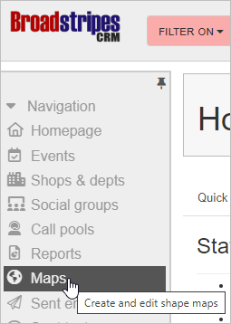
1. Start by clicking the **Maps** link on the navigation panel.
 2. Clicking this link takes you to Broadstripes' **Maps** page. You'll see the location of every person in your project (who has a good address) pinpointed on the map that appears.
3. For a better look, you can zoom in or out using the **zoom controls** on the left-hand side of the map, or with the **plus** and **minus keys** on your keyboard.
2. Clicking this link takes you to Broadstripes' **Maps** page. You'll see the location of every person in your project (who has a good address) pinpointed on the map that appears.
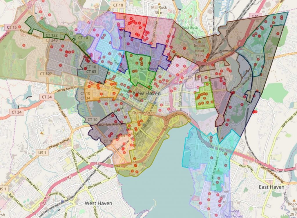
3. For a better look, you can zoom in or out using the **zoom controls** on the left-hand side of the map, or with the **plus** and **minus keys** on your keyboard.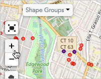 4. The **Maps** page also allows you to work with geographic shapes, whether pre-loaded political districts or hand-cut turf. These shapes can be used for political outreach, planning house visits, and other geographically informed analysis of your people.
 ## Learn more
You can learn more about maps in the [Maps overview](/docs/maps/maps-overview) and [How maps work](/docs/maps/how-maps-work) articles.
## Learn more
You can learn more about maps in the [Maps overview](/docs/maps/maps-overview) and [How maps work](/docs/maps/how-maps-work) articles.